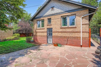
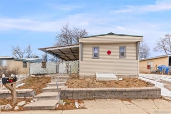
New - 4 Hours Ago
TL;DR
Map proximity to the High Line Canal Trail does not tell right-sizers whether a specific Greenwood Village, Cherry Hills Village, or Centennial address delivers practical daily trail access — the real question is whether the route from the front door to the trail requires crossing a busy arterial, navigating indirect neighborhood connections, or driving to a trailhead. Centennial offers the most walk-from-home infrastructure, Greenwood Village's Franklin St corridor is the strongest address-level case, and Cherry Hills Village requires the most careful vetting before assuming trail convenience is real.
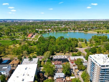
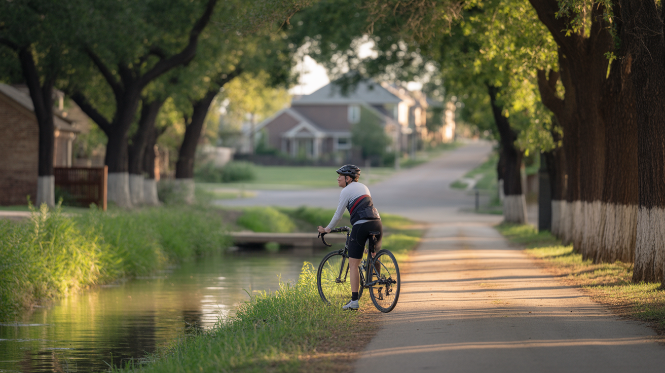
Every trail map shows the High Line Canal running through South Denver — but no map tells you whether you can actually walk to it from a specific address without crossing Orchard Road at rush hour. The trail spans 71 miles from Waterton Canyon in Littleton to Green Valley Ranch in Denver, passing through Centennial, Greenwood Village, and Cherry Hills Village along the way. That geographic breadth is exactly why "near the trail" can mean almost anything.
Most trail guides describe the High Line Canal Trail by segment, mileage, and recreation basics. What they don't do is identify which Greenwood Village, Cherry Hills Village, or Centennial addresses actually provide easy day-to-day access versus only map-based proximity. A listing that mentions trail access could mean a gate in the backyard fence or a half-mile walk to a crosswalk on a six-lane road. Those are not the same thing, and the difference matters enormously for right-sizers whose primary reason for moving is to build a daily walking or running routine without getting in a car.
The results available on most trail and real estate sites focus on trail segments and recreation basics rather than the practical access trade-offs right-sizers care about when choosing a home. Hidden frictions — busy road crossings, limited parking at trailheads, and indirect neighborhood connections — rarely surface in standard descriptions.
Four hidden trade-offs this article unpacks:
Right-sizers who chose a home based on map proximity have discovered the nearest entry point requires a car, a busy crossing, or a half-mile detour through a subdivision with no sidewalk. The verification tools that close this gap — county GIS mapping, street-level scouting, and an on-foot visit at the time of day you plan to walk — are not part of any standard listing due-diligence process. Before comparing neighborhoods, it helps to understand how the trail's crossing and entry-point structure actually works, and where the friction hides. For a parallel method of evaluating walkability claims beyond trail access, how to distinguish true walk-from-home access from map-only proximity in 10 minutes is worth reading before you tour homes.
The trail map shows a trailhead near your target neighborhood — but trailheads are built for people arriving by car, not for residents who want to step outside and walk. That distinction is the first thing to get straight before evaluating any South Denver address on trail access.
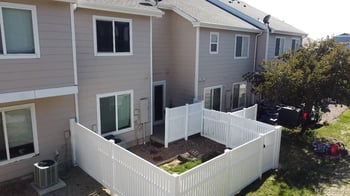
Named trailheads like deKoevend Park at 6301 S University Blvd (Segment 10) and Milliken Park at 6445 S Clarkson St (Segment 9) in Centennial offer parking, signage, and formal infrastructure. They are designed for destination visits — someone driving over on a Saturday morning, parking, and spending two hours on the trail. That is a different use case than a right-sizer who wants to walk out the front door at 7 a.m. and be on the trail in five minutes.
Residential entry points — the informal connections where neighborhood streets meet the trail corridor — are the real measure of practical daily trail access. These vary significantly by block and subdivision layout, and they don't appear on any standard trail map. A home two streets from a named trailhead may have better daily access than one directly adjacent to a segment with no safe crossing nearby.
Some of the most-marketed "trail access" addresses in South Denver sit on the wrong side of a four-lane arterial, making the trail technically close but practically inconvenient for daily use. The arterials that create the most crossing friction in the target areas are S University Blvd, E Orchard Rd, and CO-88/Belleview Ave. These are not quiet neighborhood streets — they carry real traffic, and the crossing experience at morning rush hour is meaningfully different from what you'd encounter at 10 a.m. on a Tuesday.
Potential hidden frictions like busy road crossings, limited parking, and indirect neighborhood connections are not covered in the available trail results. Right-sizers should verify whether a specific address connects to the trail via a low-traffic residential street or requires crossing a four-lane arterial — a distinction that does not appear on standard trail maps. County GIS and an on-foot visit are the only reliable tools for confirming this.
Trailhead access vs. residential entry point access:
With the crossing structure in mind, the neighborhood-by-neighborhood comparison reveals which micro-areas actually deliver on the lifestyle promise — starting with Greenwood Village.
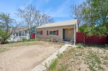
Greenwood Village carries a lifestyle premium partly on the strength of trail access — but that premium is only justified if the specific address actually delivers a walk-from-home connection. Two homes priced similarly in Greenwood Village can have completely different trail realities depending on which side of Orchard Road they sit on.
Homes on or directly adjacent to S Franklin St near the 5354 S Franklin St trailhead represent the strongest walk-from-home cases in Greenwood Village. This is a Segment 11 entry point — Trail Segment 11: Greenwood Village Amble — and the surrounding street connects to the trail via low-traffic residential streets without requiring an arterial crossing. For a right-sizer who wants to walk out the door and be on the trail without driving, this corridor is where the address-level crossings actually work in your favor.
The E Orchard Road Trailhead at 4011 E Orchard Rd (Segment 12) serves homes in the surrounding neighborhood, but E Orchard Rd itself is a busy arterial. Homes on the south side of Orchard have a different crossing reality than those on the north side — and that single block of separation can be the difference between a daily walking routine and a routine that requires a car. There are no resident voices in the available research describing whether these specific access points feel convenient for regular walking, running, or dog-walking routines, which means this is exactly the kind of thing you need to verify on foot before making an offer.
The E Belleview Rd Trailhead at 4343 CO-88 (Segment 13) sits on a state highway corridor. Walk-from-home access for most Greenwood Village addresses near this segment depends on whether a safe crossing or underpass exists nearby — and that is not something a map confirms. Greenwood Village City Hall at 6060 S Quebec St serves as a map pickup point but is not itself a practical daily entry point. Homes near Quebec St should be evaluated for whether the trail connection is direct or routed through indirect neighborhood connections that add meaningful distance and friction.
The neighborhood connection trade-offs in Greenwood Village are real and address-specific. A resident who wants to walk the High Line Canal Trail from home without driving may find that the nearest access point requires crossing a busy road or using an indirect route — even in a neighborhood that markets trail proximity prominently. Verify specific lot-to-trail distance and crossing requirements using county GIS and street-level scouting, not just segment maps. For a broader picture of how trail access fits into daily life for right-sizers evaluating Greenwood Village, what residents actually experience day-to-day after moving to Greenwood Village adds useful context that listing sheets don't provide.
Cherry Hills Village presents a different version of the same problem — and the road-crossing question becomes even more pointed there.
Cherry Hills Village is one of South Denver's most recognizable addresses — but its large-lot, low-density layout creates a pedestrian access puzzle that doesn't show up on any trail map. The village's road network was designed for cars and horses, not for the kind of pedestrian permeability that makes a daily trail routine feel effortless.
Cherry Hills Village City Hall at 2450 East Quincy Avenue serves as a map pickup point and sits near the trail corridor. But Quincy Ave is a busy arterial — residents whose homes are south of Quincy face a different crossing reality than those with direct neighborhood street connections to a public entry point. The City Hall adjacency on a map does not translate automatically to a convenient morning walk.
The village's large-lot layout means that even homes nominally close to the trail may require a longer walk through private or semi-private streets before reaching a public entry point. Indirect neighborhood connections are a real friction here, not a theoretical one. Potential hidden frictions like busy road crossings and indirect neighborhood connections are not covered in the available trail results — and Cherry Hills Village is the area where those frictions are most likely to surprise a right-sizer who assumed proximity meant convenience.
A right-sizer comparing homes in Greenwood Village, Cherry Hills Village, and Centennial needs to know whether trail access is truly walkable from the address or only nearby on a map. In Cherry Hills Village, the honest answer is that this requires more careful address-level vetting than in either of the other two areas. The village's road network was not built for walk-from-home trail routines, and the gap between map proximity and lived convenience is wider here than anywhere else in the comparison.
Cherry Hills Village suits right-sizers who value land, privacy, and the trail as a weekend destination rather than a daily walk-from-home asset. If a car-free morning routine is the primary goal, the address-level verification burden here is higher — and the likelihood of finding a home that delivers on that specific promise without a busy road crossing or a private-road detour is lower than in Centennial or the Franklin St corridor in Greenwood Village.
Before making an offer in Cherry Hills Village, verify:
For a direct comparison of how Cherry Hills Village stacks up against Greenwood Village and Centennial on daily-life convenience — including walkability realities that residents notice after moving — how residents compare these three areas on daily convenience after the move is worth reading alongside this article. Centennial offers a different profile — more trailheads, more grid-pattern streets, and more address-level clarity, but with its own trade-offs worth examining.
Centennial rarely leads the conversation when right-sizers talk about South Denver lifestyle — but its two named trailheads and grid-pattern streets may make it the most practical daily-access option of the three target areas. That's not a marketing claim; it's a structural observation about how street layouts and trailhead density translate into walk-from-home convenience.
Centennial offers two named trailheads with formal parking and entry infrastructure: deKoevend Park at 6301 S University Blvd (Segment 10) and Milliken Park at 6445 S Clarkson St (Segment 9). That makes it the most trailhead-dense of the three target areas for right-sizers seeking practical daily trail access. More infrastructure means more options — but infrastructure alone doesn't answer whether a specific address delivers a walk-from-home connection.
Homes on or near S Clarkson St in the Milliken Park corridor represent the stronger walk-from-home candidates. S Clarkson St carries low traffic compared to S University Blvd, which reduces the arterial-crossing friction that affects University Blvd-adjacent addresses. For a right-sizer who wants to walk the trail without driving, the Clarkson corridor is where the daily math works most consistently.
The deKoevend Park trailhead sits on S University Blvd, one of the area's busiest arterials — so the "best trailhead" address isn't automatically the best walk-from-home address. Homes on the east side of University near deKoevend Park face a different crossing reality than those with direct neighborhood street connections to the park's trail entry. The search results do not identify which specific Centennial addresses actually provide easy day-to-day access versus only map-based proximity — which means this is a gap that requires county GIS and on-foot verification to close.
Goodson Recreation Center at 6631 S University Blvd serves as a map pickup point and community anchor, but it is not itself a primary trail entry. Right-sizers should not conflate recreation center proximity with walk-from-home trail access — these are different things on the same street.
Centennial's more grid-pattern street layout in many neighborhoods means that homes within a quarter-mile of the Milliken Park or deKoevend Park corridors often have more direct pedestrian routes than comparable Cherry Hills Village addresses at the same map distance. Limited parking at both trailheads can be a factor on weekends — confirm current parking availability with the City of Centennial parks department before assuming the trailhead is a reliable drive-to option when you want it. For a fuller picture of how Centennial's location and street network affect daily life beyond trail access, how Centennial's street network shapes the full daily-life picture for right-sizers adds useful context. And for connecting trail access to property selection, which home types in Centennial and Greenwood Village best match right-sizer priorities is worth reviewing alongside the access question.
With the neighborhood-by-neighborhood picture complete, the next question is how to actually compare specific addresses before making an offer — and that requires a verification workflow, not just a map.
Three South Denver areas, all marketed with trail access — but the daily experience of living near the High Line Canal Trail is not the same in all three. The area with the most prestige has the most indirect connections. The area most often overlooked has the most walk-from-home infrastructure. That inversion is worth sitting with before you narrow your search.
Greenwood Village
Trail segments: 11–13 (Franklin St, Orchard Rd, Belleview)
Crossing friction: Moderate — address-specific; Franklin St corridor is strongest
Street layout: Mixed residential and arterial
Verification priority: High — which side of Orchard Rd matters significantly
Cherry Hills Village
Trail segments: Near Quincy Ave corridor
Crossing friction: High — large-lot layout produces indirect neighborhood connections
Street layout: Low-density, not designed for pedestrian permeability
Verification priority: Highest — public vs. private road status must be confirmed
Centennial
Trail segments: 9–10 (Milliken Park, deKoevend Park)
Crossing friction: Lower in Clarkson corridor; higher near University Blvd
Street layout: More grid-pattern; more direct pedestrian routes
Verification priority: Moderate — Clarkson corridor is most consistent
The results available on most trail and real estate sites focus on trail segments and recreation basics rather than the practical access trade-offs right-sizers care about when choosing a home. The address-level crossings and neighborhood connection trade-offs that actually determine daily convenience don't appear in those descriptions.
A right-sizer comparing homes in Greenwood Village, Cherry Hills Village, and Centennial needs to know whether trail access is truly walkable from the address or only nearby on a map. Here is the honest version of each area's trade-off:
Greenwood Village offers the strongest combination of trail segment variety and neighborhood character, but access quality is highly address-specific. The Franklin St corridor is the strongest daily-access case. The Belleview and Quebec corridors require more verification. The lifestyle premium is real — but it reflects the neighborhood as a whole, not trail convenience specifically. Right-sizers should weigh whether the premium reflects trail access or other attributes before assuming the two are the same thing.
Cherry Hills Village delivers land, privacy, and trail adjacency — but has the most indirect neighborhood connections of the three areas. If a car-free morning walk is the primary goal, this is the area that requires the most careful address-level vetting. The prestige is real; the pedestrian infrastructure is not.
Centennial offers the most trailhead infrastructure and the most grid-friendly street layout for walk-from-home access. For right-sizers whose primary goal is daily trail use without driving, it is the most consistently practical choice of the three — even though it rarely leads the conversation.
No neighborhood-wide claim about trail access is reliable without confirming the specific lot-to-trail route, crossing type, and parking situation for the address under consideration. Knowing the trade-offs by area is necessary but not sufficient — the final step is a practical verification workflow for any specific address before making an offer.
Every right-sizer who has been disappointed by a "trail access" home followed the same path — they trusted the map and skipped the walk. The verification steps that actually matter are not part of any standard listing due-diligence checklist, and there are no resident voices in the available research describing whether specific trail access points feel convenient for regular walking, running, or dog-walking routines. That gap is exactly why you need to close it yourself before making an offer.
Five-Step Trail Access Verification Checklist
The practical daily trail access you're evaluating is not a feature that can be confirmed from a desk. The entry points that work for daily routines — the ones that connect via low-traffic residential streets without arterial crossings — are the ones worth paying for. The ones that require a car trip or a stressful road crossing every morning are not, regardless of what the listing says.
With this workflow complete, the decision shifts from "which neighborhood has trail access" to "which specific address delivers the daily routine I'm actually moving here for." For a parallel method of evaluating walkability claims across any South Denver address, how to verify whether a Colorado address is truly walkable or just nearby on a map covers the broader framework. And since Colorado's winters affect trail usability and crossing safety in ways that a summer visit won't reveal, how seasonal conditions affect South Denver daily life for out-of-state buyers adds a time-of-year dimension that the verification workflow above doesn't cover on its own.
Your Real Estate Expert. Regarding real estate in the Denver Metro market, you deserve an expert who places your needs above all else. I'm Brian Burke, a licensed REALTOR® and seasoned real estate broker and owner of Kenna Real Estate with over two decades of experience. I've helped hundreds of home buyers and sellers navigate every transaction, and my comprehensive industry knowledge spans from appraisal to mortgage to real estate expertise.
My dedication to excellence has earned me recognition as a pricing specialist. This allows me to find the best solutions for even the most unconventional transactions to benefit my clients. Consider me your trusted Real Estate advisor for your next transaction, whether it's for yourself, a loved one, or a friend. Always choose an agent who aligns with your needs, even if that means exploring other options.
You may not be aware that I've held a REALTOR® license since 2002, dedicating my time to becoming an authority in all aspects of Residential Real Estate and Construction. In addition, I established my own Real Estate brokerage firm, providing comprehensive 360-degree Real Estate services, from the initial acquisition of a client's first Real Estate asset to the disposition of their entire Real Estate portfolio.
My commitment is unwavering in delivering top-notch service that consistently exceeds my clients' expectations, whether you're selling or buying. Even after the transaction is complete, I remain your lifelong REALTOR®, ready to assist you at any time. When you, your family, or friends choose me as your Real Estate agent, I promise to be the best agent you've ever worked with in the Real Estate industry.
Proudly serving Arapahoe, Douglas, El Paso, Denver, Jefferson, Weld, Lairmer, Elbert, Broomfield, Boulder, and Adams Counties! I have a team of anents in most Colorado cities from Fort Collins, to Grand Junction, to Denver, and Colorado Springs.
This is what You Get when I sell your house:
When it comes to your real estate, trust in a dedicated professional who puts your goals first. Contact me, Brian Lee Burke, today, and let's turn your real estate dreams into reality.